

GIS Products
We are silver partner of ESRI, the world leading GIS and Mapping Software developer. ESRI’s ArcGIS platform enables you to discover, use, make, and share maps from any device, anywhere, at any time. ArcGIS core products are used to implement the right ArcGIS framework for any organization. With them, one can create maps and apps and provide mapping capabilities to anyone using apps
ArcGIS Desktop
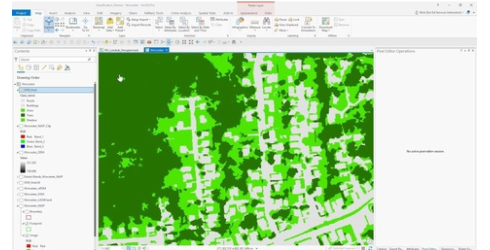
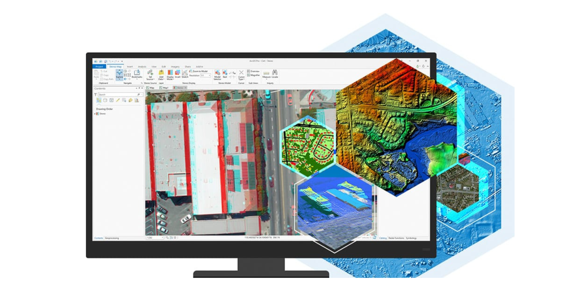
ArcGIS Desktop is a foundational piece for GIS professionals to create, analyze, manage, and share geographic information so decision-makers can make intelligent, informed decisions.
It allows you to create maps, perform spatial analysis, and manage data. You can import multiple data formats and use powerful analytical tools and workflows to identify spatial patterns, trends, and non-obvious relationships.
What can ArcGIS Desktop lets you Do!
- Perform complex GIS analysis, including geostatistical, raster, and 3D modeling.
- Create detailed maps with cartographic tools for accurate representation of geographic data.
- Modify, clean, and structure GIS data for better integration and analysis.
- Use ModelBuilder and Python scripting to automate repetitive GIS workflows.
- Analyze terrain, infrastructure, and urban planning with 3D GIS capabilities.
- Access and edit spatial data without an internet connection, ensuring seamless field operations.
Key Facts
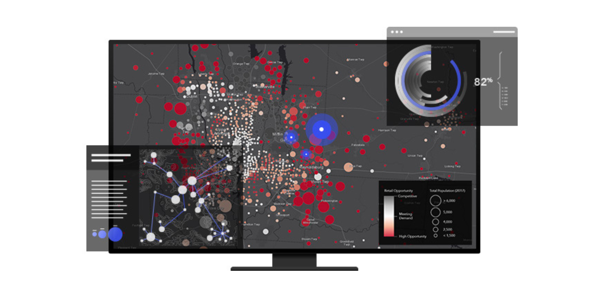
ArcGIS Online
ArcGIS Online is Part of the ESRI Geospatial Cloud, ArcGIS Online enables you to connect people, locations, and data using interactive maps. Work with smart, data-driven styles and intuitive analysis tools that deliver location intelligence. Share your insights with the world or specific groups.

What can ArcGIS Online let you Do!
- Create, share, and analyze maps from any device with an internet connection.
- Incorporate live feeds, such as weather, traffic, and IoT sensor data.
- Share interactive maps and dashboards with teams or the public.
- Access powerful GIS tools directly through a web browser.
- Build and deploy GIS applications without coding, using templates and configurable tools.
Key Facts
ArcGIS For Server
ArcGIS for Server is software that makes your geographic information available to others in your organization and optionally anyone with an Internet connection. This is accomplished through web services, which allow a powerful server computer to receive and process requests for information sent by other devices. ArcGIS for Server opens your GIS to tablets, smartphones, laptops, desktop workstations, and any other devices that can connect to web services.
To get started with ArcGIS for Server, you’ll need to prepare your hardware, software, and data, then you can set up GIS web services. Finally, you can use various types of applications to consume your services.

What Makes Us Different
- Host and manage GIS data for enterprise-wide access.
- Turn GIS workflows into web services accessible across different platforms.
- Run large-scale geoprocessing and analysis tasks without local performance limitations.
- Control access and permissions while scaling services for growing demands.
- Connect GIS capabilities with ERP, CRM, and other enterprise software.